In 2010, a promotional video of Rason’s urban masterplan was released. Focusing on the Rajin District, there were extensive computer generated images and fly-through, taking viewers through monumental avenues and attractive landscapes while elaborating on the importance of an urban development plan in order to create a well-functioning city. The plan divides the Rajin District into various areas: Central, Ansu, Changpyong, Sosang, Geokjeon, Dongmyong, which contain specific functions. Government buildings are located in the Central and Sosang area while exhibition halls are located in Changpyong and factories in Yeokjeon.
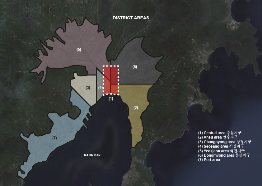
The biggest part of the video was dedicated to Ansu, which aims to be a hub for finance and tourism. The area will be divided into six smaller zones (commercial, financial, cultural, housing, foreign residence, sports) stringed together linearly along the narrow eastern coastline of Rajin bay. Compared to the industrial facilities of Rajin Port on the opposite side of the bay, Ansu by contrast aims to attract foreigners by providing a mixture of financial center with spaces of leisure and entertainment along the waterfront.
While the video expresses the grandambitions of Rason, the complexity in realizing it is equally immense. There are various factors that urban planners need to consider, ranging from the development of technological infrastructure required of a contemporary networked city to the physical size of the city, which will determine its fundamental characteristics.
In general, the physical nature of Rason is governed by its hilly geographical terrain, which may limit the future expansion of the city. Given such constraints, what can we infer from the current boundary of the city? Is it an optimum size for accommodating a suitable population density and does it have good quality urban spaces which in turn attract people to work and live in the city? Does its physical size need to grow or is it already too large and sparse?
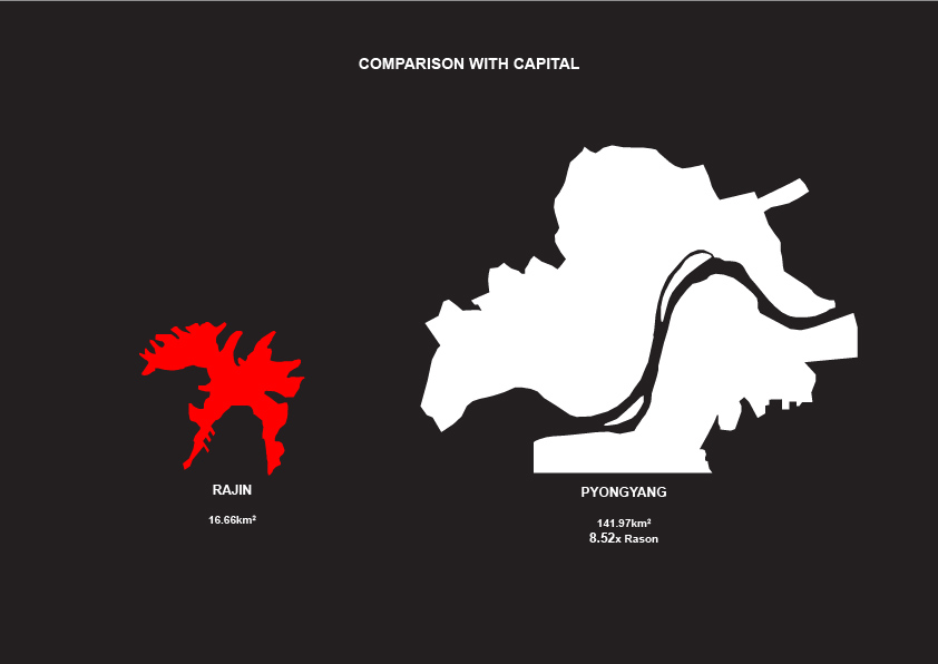
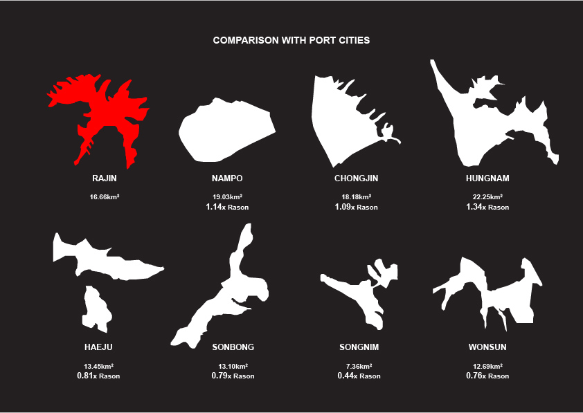
Perhaps we can have better glimpse into Rason’s future by benchmarking its size against other cities, economic zones and hubs. The following diagrams compare the size of Rajin district to other port cities, SEZs within North Korea, foreign specialized SEZs/research hubs and mixed-used SEZs.
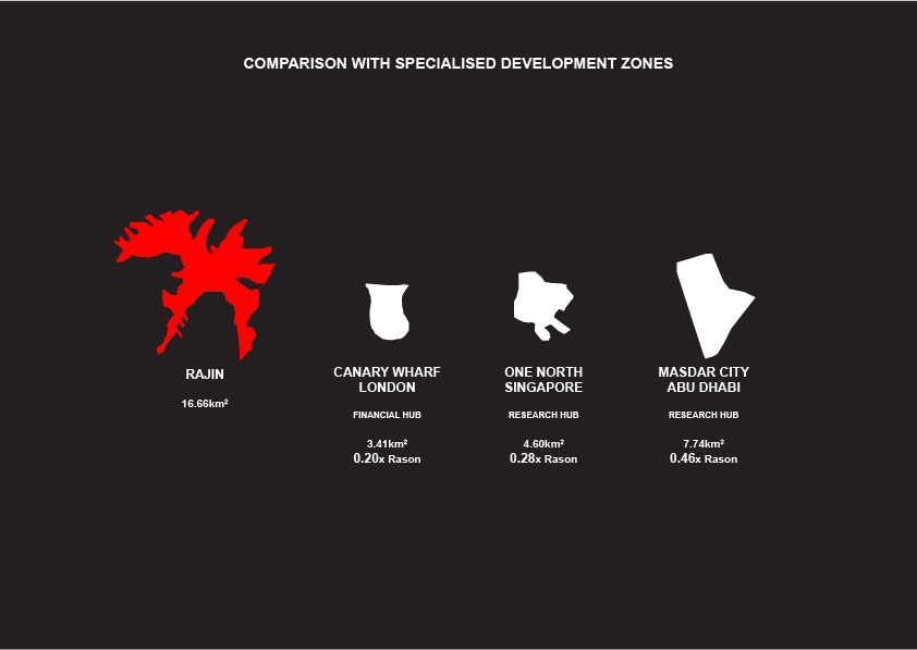
The district is 16.66km2 large, about a tenth of the size of Pyongyang.
It is approximately the same size as other SEZs in the DPRK, both proposed and in operation.

It is also not dissimilar to other North Korean port cities.
However, when compared to cities overseas, one can start identifying stark differences. Cities with specialized services, such as the financial hub of Canary Wharf in London, research hub in One North Singapore and Masdar City in Abu Dhabi, are all at least 50% smaller than Rajin District.
However, when compared to other mixed-use economic zones, such as Songdo City, Tianjin Eco-City and Suzhou Industrial Park, Rason’s development is smaller in scale.

Another important characteristic of these developments is the close proximity to airports which provides easy access for business travelers. Songdo is 14km away from Incheon Airport, Canary Wharf is 4km away from London City Airport, and Masdar City is right beside Abu Dhabi Airport.
In general, we get a few takeaways from benchmarking Rason against other cities and SEZs. Firstly, Rason being a mixed use economic zone is not large when compared to the Chinese examples. Ansu which is planned to be a specialized financial and tourism hub is about a fifth of the entire Rajin district and is comparable in size to the specialized hubs of One North or Masdar City. Secondly, most of these developments, especially the mixed-use economic zones develop in phases over at least a 20 year time period. Finally, the development of an airport could be a very important factor to ensure the accessibility of the city, which Rason is currently lacking, given its geographical isolation.